SPECIAL FEATURE: A Postcard from Australia
In this special guest posting Simon "Dundee" Cotter, avid commentator and friend of TCA, provides an insight into Mountain Biking in Australia, near his home in NSW. Bowen Mountain lies about 80km west of Sydney and is a joining the world Heritage listed Blue Mountains National Park. Close by is the Wollemi National Park, home to the famous Wollemi Pine. Here is an account of Simon's regular outing.
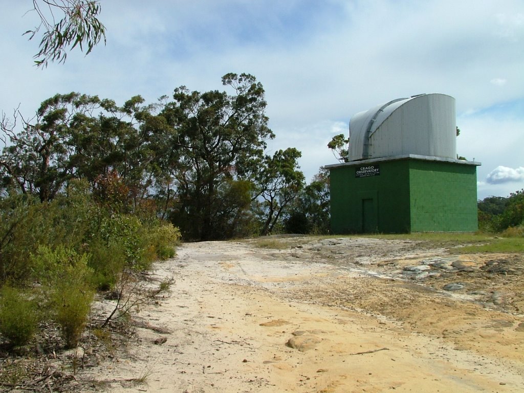 The Ride commences at the Craigo Oberser- vatory (left), which lies at the northern end of Bowen Mountains (33° 33' 50" S; 150° 37' 15" E) at a height of 469 m. It is an astronomical observatory (telescope: 16” ƒ/7 Dob) of the Astronomical Society of New South Wales. After 8kms or so the trail descends into the Burralow Valley; the track, formed from part of the original Bells Line of road. The Burralow Valley itself has an interesting history: Now a pleasant place for campers, it covers a couple of hundred acres and was Australia's first rice farm. Worked by convicts, the Burralow with its continual spring fed water supply, seemed an ideal location. Nothing remains of the original homestead, although ruins could be seen 20 years ago. Careful riding and observation will reveal the remains of the convict lock-up as well as some road forming.
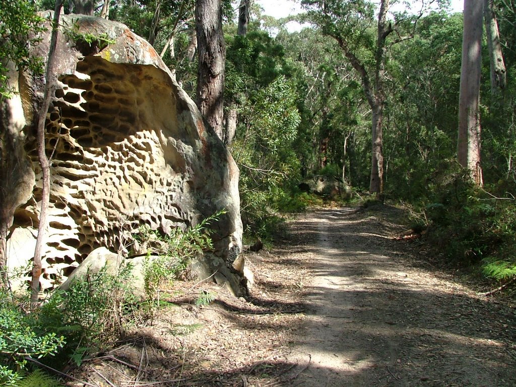 The trail that desends from Bowen Mountain (right) is a strong mix of rough rock strewn fire trail with nasty sand wash outs, exposed cliff faces which are in stark contrast to the cool rain forests tha exist in the gullys. The descent is very steep in parts and due care is needed with the need to be well over the back wheel, swapping rapidly to a standing position to 'power' out of creeks and wash outs [I hope you're taking notes Billy-Bob, Ed.].
Upon arriving at the bottom and crossing Burralow creek, a continual steady climb to Bilpin is in order. The first 4 klm is steep enough that careful placement of body weight is essential. Too far forward, and the rear wheel will slip, to far back and and the front wheel lifts. Due application to "mind set” needs to be applied as well. The wrong gear or too fast at the start will cause the rider to mis judge and "blow" well before the summit. The ride from Burralow to Bilpin in this first 4 km is exposed, and the track has a “quartz like” look. The reflective element of the sun makes it very hot. 3 litres of water is advised, and plenty of sun block.
 Simon's Bike, the "Marie Celeste"
On reaching the top the next 6-8km is a leisurely climb through small gums, and bush. Lunch at a favorite log is usually order of the day (above) before returning. In terms of time the ride can be broken down like this: Observatory to Burralow 20 minutes; Burralow to Bilpin 1 hour; Bilpin to Burralow 15 minutes; Burralow to Observatory 45 minutes, Such are the steep climbs.
 There are a number of tracks leading off the main, e.g. Donna track & RAAF track. there are superb views of the Grose river gorges (left) and Mt Banks from the donna track especially. Highlight of the ride are the creeks and convict ruins as well as the stark contrast of exposed areas of track Vs sudden cool of rain forest. Wildlife often seen are Goanna, Brown snake, bearded Dragon, If you are lucky a Glossy Black Cockatoo, Stinky swamp wallaby or eastern Grey Kangaroo.
"G'day. Bonzer! Will ya look at this brute! Jeeze, stand back now kids or it'll have yer arm off!" Simon exclaimed before bracing the mighty beast's jaws open with a branch.
Things to watch out for:- A lot of the track is used by 4wds. Occasionally you will meet an idiot. it is best to be well to the left. Also the sand at the bottom of a decent can be tricky. Depending on the weather the sand can be very soft causing loss of momentum and a spill. Quite a risk if you are on your own.
(Posted by: Simon)
Labels: Postcard
posted by TCA @ 1:58 pm
8 comments
![]()


8 Comments:
Simon it looks beautiful - but I think I'd rather walk it... too hard for me! Some lovely photos too.
thanks.. the lizard was about 4 cm long ha! I feel very honoured to see the ride on the TCA!
Isn't that rock in the second picture near where I dropped and busted my new digital camera when I was jet-lagged and under the influence of my first VBs?
yep! spot on...
Simon - It looks and sounds a top route! you have raised the bar a tad on route description I will have to pull my finger out.
B.B.
P.S. nice bike.
Thanks!... Did the same ride yesterday in pouring rain.. changes the track behaviour completely and added and extra hour. The track seems to have a lot of clay and was really "sticky" and slow.
The bike:- It's really perfect for the sort of terrain I ride in.
Hard Tails are more popular in Victoria where the tracks are more "Cross Country" not "All Mountain". Aluns Scott(as an example) would be faster (lower bottom bracket etc) on smoother trails and less tiring to ride, ... but the exact opposite in the terrain I am in...so its "horses for courses" :o)
Hardcore ride i reckon, us poms'l have to up our game for sure!
Ad
does anyone know if you can ride horses along this track?
Post a Comment
<< Home