Thursday, December 07, 2006

Forth Road Runner

Technically I suppose the TCA, being an association, is all about group activities. However, it being TCA night with slim prospect of a posting I thought I would mention my solo effort: While away from home in Scotland I like to stay at The Priory Lodge in South Queensferry. Sandwiched on the shore between the famous rail and road bridges, it's conveniently located near the airport and major routes to the north and west, as well as Edinburgh city centre.

The forth road and rail bridges from South Queenserry

However, it's also got a delightful village-like feel to it with a chippy (translation for kiwis: fush & chup shop, Ed.), a superb curry house, a swish seafood restaurant (for entertaining colleagues/customers) and a blinding pub - The Ferry Tap - which serves Dark Island from Orkney, one of my all-time favorite beers. All these establishments offer spectacular views of both bridges and across the Firth of Forth to North Queensferry. This is Home from Home for the seasoned traveller.

What's this got to do with the TCA (I hear you ask)? Well, to justify the Orkney Dark and Queen's Spice chef's special chicken madras I often go for a run up and down the shore. With my legs still a bit stiff from the weekend's Ulverston Xmas Pud 10k I though tonight in particular would be ideal for a gentle run to loosen everything up a bit before my traditional night out. Still not worth a post really but tonight I had a long-held ambition in mind - to run across the 3300ft Forth Road Bridge to North Queensferry and back.


The forth road bridge

Having made a recce the previous evening to determine whether the feat was possible (in terms of pedestrianisation rather than distance), running to the apex and back, tonight was the night for the full length. The evening before was a lovely evening; calm, moonlit night and the bridge offered great views of the famous red rail bridge to the east, and a nice photo opportunity. It was a little breezy tonight, cold - 6 degrees C - and light rain in the air. Still, a spectacular place to go for a quick run before dinner. what's more tonight was the night the Christmas lights are turned on in Queensferry and the fireworks added to the sense of occasion.
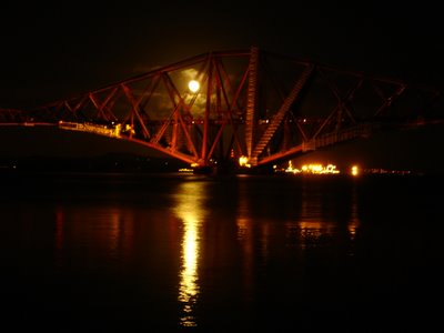
The forth rail bridge by night


Must get my hands on a bike next time... and some Scottish friends.

(Posted by: Al)

Labels: ,

Wednesday, September 27, 2006

In Search of Nessie

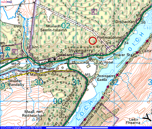
Having had a long walk in Glen Nevis in the morning we had decided to push on towards Loch Ness to make camp fo our last two nights before heading South towards Edinburgh and eventually home. We happened upon a Invergarry, on the banks of Loch Oich, and the Faichem camp site perched on a hill (more about this hill later) to the west of the village (Map 1).

With only a rather anonymous hotel in the village as a local option, and with the 'who's driving' debate still unresolved, we once again resorted to our trusty steed in our search for dinner. The first section of the ride was a blast, flying down the hill from the farm towards the road. Our original intention was to pick up the Great Glen cycle route which runs through the forest above the main road. However, a quick recce on foot showed that this was not really suitable terrain for the tandem so we decided to use the main A82 along the banks of the Loch.

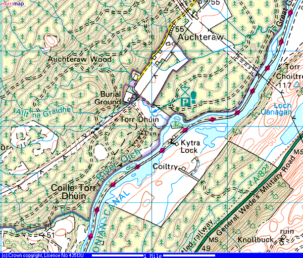
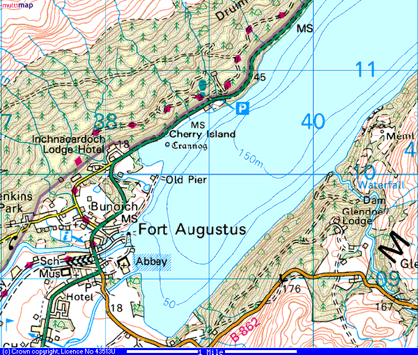
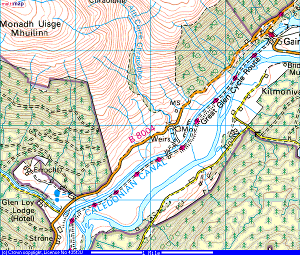
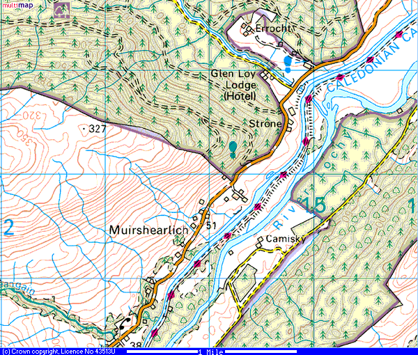
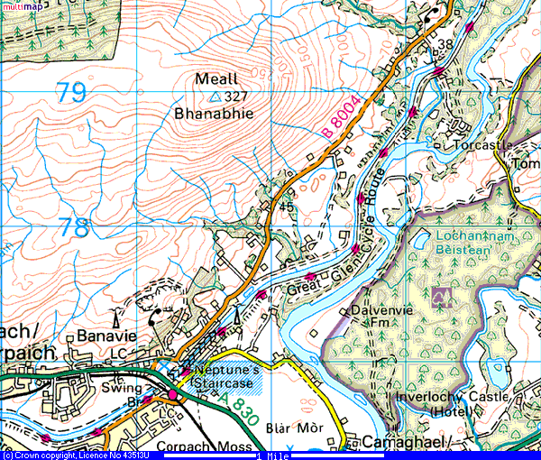
After 2-3 miles we found we could pick up the cycle route again at the Bridge of Oich (right), using the tow path on the west bank of the Caledonian Canal (Map 2). This tow path lead the rest of the 4 miles with the canal on the right and the river Ness on the left (Map 3) until it reaches Fort Augustas at the southern end of Loch Ness (Map 4).

This is a pleasant town which has a number of places to eat. We chose the 'Lock Inn & Gilliegorm Restaurant' (above) where we both had venison stew and pints of Caledonian IPA, magic!

Outside though the weather was not 'magic' - it was taking a significant turn for the worse - steady rain and driving wind -proper Scottish weather! This was turning into a proper full-on TCA ride! With 7 miles back to the camp site we both put our heads down and peddled, hard, into the wind. 40 minutes or so later we arrived back at Invergarry, soaking wet, and now we had to climb the mile or so up the steep hill, which we had relished flying down earlier, pushing the tandem. Eventually we got back to the tent, peeled our soggy clothes off in the porch of the tent and climbed into our new, and very warm, down sleeping bags. We made a mug each of hot chocolate in the light of our storm lamp on our new 'pocket rocket' primus stove (Billy-Bob & Da you will love this bit of kit when you see it - a micro-burner with piezoelectric ignition, 96g, Ed.) which we had listening to the sound of rain against canvas. Happy Days - now THAT'S why we love being in the TCA!


Route Maps:

Map 1


Map 2


Map 3


Map 4

(Posted by: Al)

Labels: , ,

Monday, September 25, 2006

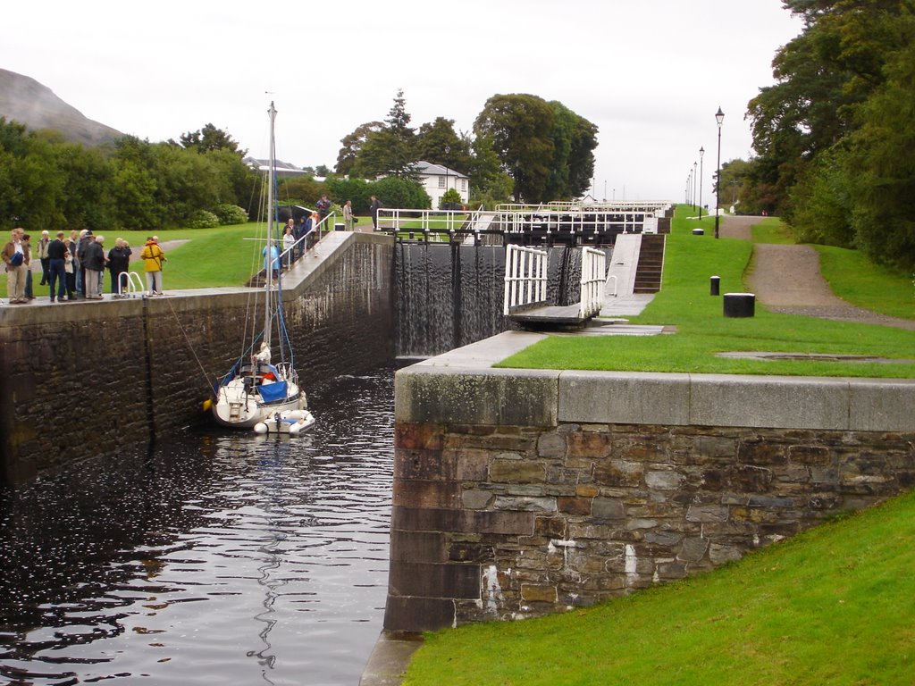
Neptune's Staircase

We did this route twice on consecutive evenings more out of necessity than in pursuit of a leisure ride: After 6 nights in a tent on Mull, surviving 'hurricane Gordon' and a tortuous drive across the Arnamurchan peninsula we fancied a night in a real bed, and a slap-up brekkie! We plumped for the Glen Loy Lodge (Map 1), an old hunting Lodge which was located away from the sprawl of Fort William in a quiet Glen. However, we had to find dinner and, since we have never been very good at resolving the 'who's driving' debate, the tandem was the only clear choice for transportation.

We took a look at our road map and figured that if we initially headed in the wrong direction on the main road adjacent to the Lodge that we could find a way onto the Great Glen cycle route rather than take the road into town.

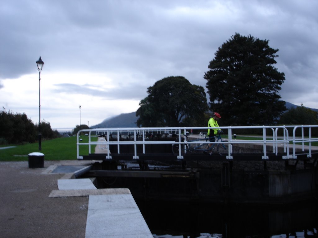
As the B8004 dropped down the hill into Gairlochy (just off the top of Map1) and over the canal towards Spean Bridge we found that we could join the tow path on the east bank of the Caledonian Canal (above). We then headed back in the direction we had come from, along the well maintained cycle path, following signs for Fort William. The paths wends its way next to the canal back past the B&B on the opposite bank (Map 2), and over an aquaduct (surely a first for the TCA?).

Eventually the cycle path reaches Neptunes Staircase (right), a flight of locks where the Caledonian Canal drops down to Loch Linnhe (Map 3). Rather than continue to Fort William we crossed the locks here and found The Moorings, a hotel backing onto the locks. The Moorings bar was well below TCA standards (poor beer) but then did serve a nice pint of heavy and had a nice selection of malts from which Al chose low-fat starters before dinner (The local 'Ben Nevis' was suprisingly good despite the touristy name!).

Having eaten a rather ordinary but perfectly adequate meal we went to pick up the bike from the car park, finding that it had started to rain both evenings. Fully waterproofed we set off back to the Glen Loy on the B8004 (Map 3). This was the darkest, quietest road we'd ever been on which made for a very atmospheric ride, all lights blazing. We got back to our B&B, complete with real bath and bed, in about 25 minutes, the shorter return route cutting the ride time in half. Who needs taxis, eh?

Al leads the tandem across the staircase, slowly.


Route Maps:

Map 1


Map 2


Map 3
(Posted by: Al)

Labels: , ,

Friday, September 22, 2006

Duart Castle Duo

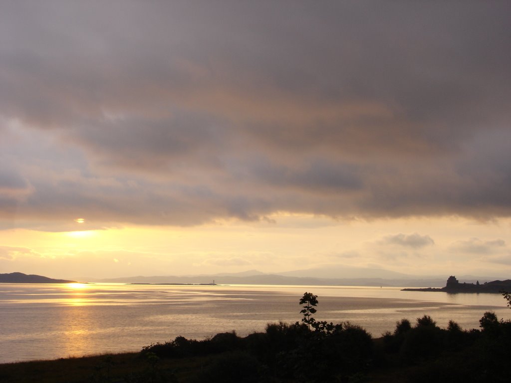
Our camp site at Craignure, on the east coast of the Hebredian Isle of Mull, afforded magnificent views of the mainland across the sound of Mull and of Duart Point across the bay to the southeast (above, left). While niether of us are 'stately homes & castle type' people we got back in from a busy day's sea eagle watching and fancied a quick cycle-an'-a-pint TCA style before dinner.

We set off out of Craignure on the 'main' single-track road, pulling into the passing places to allow bewildered local motorists pass our machine. We passed the entrance to Torosay Castle and thought about a two-castle ride, but it seems apparent from the local guide books this is more 'stately home' than 'castle' and not really a suitable target of our mission. We therefore pressed on up the main road taking the third left turn out of the villiage

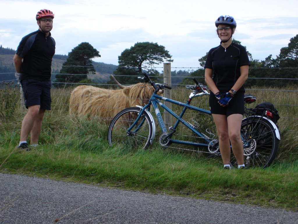
Turning off the main road onto a tarmaced track it soon became clear that we were definitely in Scotland, with Highland cattle roaming the ground of the estate (right). The road undulated pleasantly with twists and turns that made the it feel like a roller-coaster ride. We covered the 2-3 mile route to the castle in just a few minutes, arriving just as the castle itself was closing to visitors for the day.

However, this was perfect timing as we managed to bump into Lady McClean, the current resident and ex-lady in waiting to the Queen Mum! She seem to take quite a shine to us and our bike and invited us to wander the grounds desipte it being out-of-hours. We politely declined but hung around a while to enjoy the magnificent views afforded from the ramparts.

Having taken in the views we set off back up the road and out of the castle grounds (nearly scaring the Lady of the manor half to death as we rattled over the cattle grid). As you can see we couldn't resist posing with some of the residents on the way back to Craignure.

Fortunately the village is blessed with a cracking boozer (right), where we sought refuge from our dehydrated camping diet and 'hurricane Gordon' a couple of times earlier in the week, and wherw we would enjoy a live local band on the following Saturday night. This evening though the Craignure Inn doubled as the TCA watering hole; Tee opting for her tipple of choice when north of the border - 'heavy' (Tennant's 'Ember' 70 shilling on this occasion) - while Al had a pint of the locally brewed Tobermory Galleon Gold.

Trudy trying to spot a B&B on the way back to our sodden tent


Route Map (showing our camp site in the NE and Duart Castle in the SE):


(Posted by: Al)

Labels: , ,